Geography 2.0: Virtual Globes

AAG2007 Virtual Globes Logo

Saturday, January 28, 2006

Local meets SimCity

Given the Chinese enthusiasm for digital earth, I've been eager to learn about their latest innovations. I am expecting to get a full update at the next International Symposium for Digital Earth, San Francisco, 2007. For now, however, the website www.edushi.com reflects some interesting work that is happening.

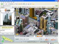
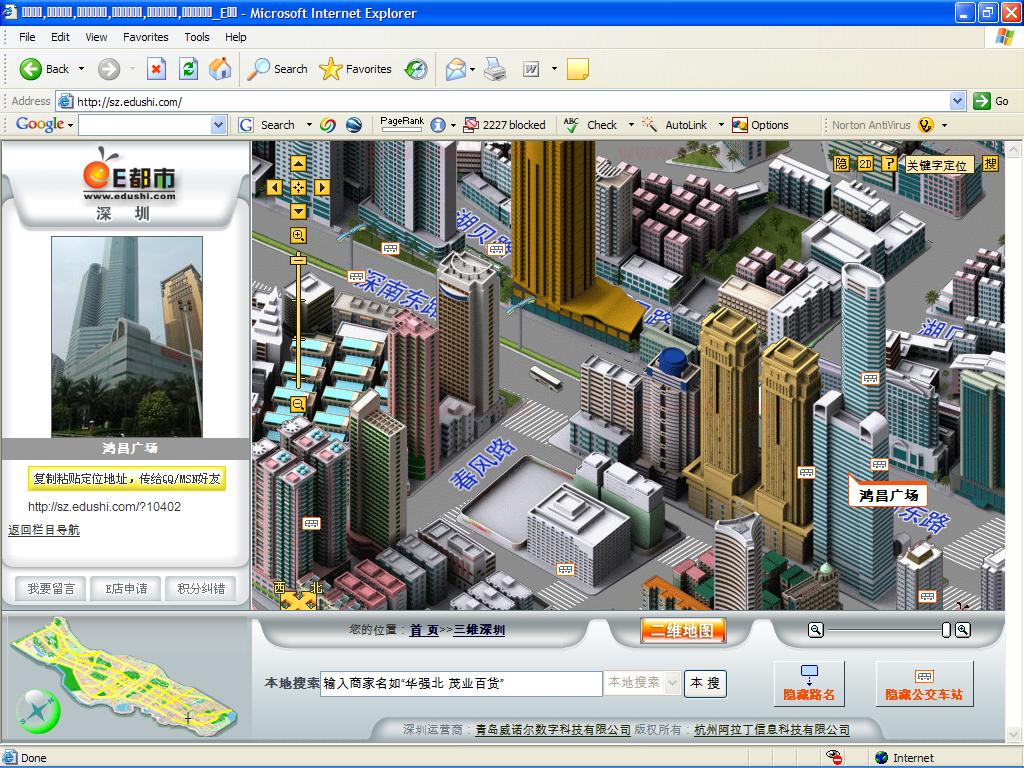
Using an ajax-enabled interface with similar look and feel as other popular map sites, Edushi serves idealized 2.5D, Sim-City-like city maps. As observed by a description at the Virtual Terrain Project, the maps are "clearly built on an extremely detailed and impressive GIS database". For instance, each building--and there are thousands--holds the footprint, relative height, and a general appearance of its real-life counterpart. Also, if you click on many structures or landmarks, a photograph and other information appears on the sidebar.

I do not read Chinese, but it looks like Edushi is using the following data:

  • buildings/landmarks: footprints, heights, idealized appearance, photographs.

  • street map data (including 3D data for overpasses)

  • street addresses

  • a business database

  • land cover (parks, water, sidewalks, etc.)

  • smoothed terrain

  • bus stops

  • construction data (cranes are seen around some buildings under construction)


Currently, the site includes portions of Foshan, Hangzhou, Qingdao, Shanghai, Shenzen (in beta), and Qingdao. Though you can toggle on-and-off the buildings, no satellite imagery or aerial photography exists to complement the maps.

Edushi is an impressive implementation, and further illustrates the lightning pace of internet-based mapping experimentation and innovation.


Comments on Map Cognition...
I do not know of research to show that 2.5D perspective maps are more meaningful for navigation or that such maps necessarily allow humans to better understand their environment. However, the existing research would have been done on static maps. These new maps and renderings allow for interaction by the user, and, importantly, that interaction can sometimes occur in the field. How such maps and renderings effect our understanding of the world, how we navigate, and how we make spatial decisions, is a rich subject for study. Another important question is determining how quickly we can mentally query and process information from these maps (and at what scales)--in order to determine whether they make a desirable interface for in-vehicle navigation.
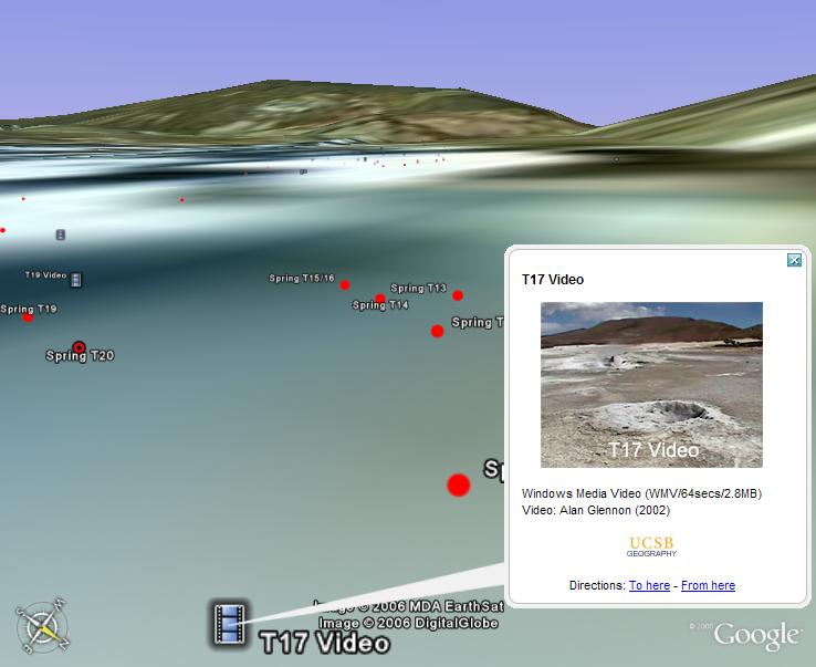
Friday, January 27, 2006

Geoweb 2006 conference website

Dr. Keith Clarke, the department head here at UCSB Geography, just forwarded me an email regarding the Geoweb 2006 Conference, Vancouver, July 24-28, 2006. Though their website is not really developed, they describe it as:

...the premier conference for Web-based geographic information systems--the meeting point of consumer location services and professional geographic information technologies: Geography Markup Language (GML), KML, MapPoint, LandXML and OGC Web Services for GIS.

The call for papers provides more detail on the types of talks expected. Registration is around the $1000 mark, and the student rate is 50% of that.

Geovantaged Imagery - KML LookAt

In the last paragraph of my previous post, I refer to having a strong cognitive connection to being able to "view a scene from the same position where I originally took a photograph". To clarify, here is a screenshot. Using the KML "LookAt" tag, an image can be referenced to both its geographic location and the camera vantage. Note that the horizon and ground coloration approximately match in the Google Earth representation and in the thumbnail image.


The photograph is of El Tatio Geyser Field, Chile. Though the imagery and elevation model is not high resolution, the connection between the photograph and the Google Earth scene allowed me to recall details of the location which I thought I had forgotten--there was actually something of a "eureka" moment.

Those fluent with Google Earth will find the tagging process easy; it can be done within the user interface without any manual KML coding. Another alternative is Surveylab's Ike unit--bundling a camera, GPS, laser distance finder, compass, and clinometer. With a little code, the whole "geovantaging" process could be automated.

If anyone knows of associated research literature dealing with such images, I would be very interested in hearing from you.

If you would like to view numerous interactive examples, visit the "Views" folder of my Chile Geysers KML database.

Will Microsoft have a Google Earth?

So, will Microsoft launch something that looks like Google Earth? As seen in the preview screenshots for Flight Simulator X, Microsoft has the ingredients in place to do it. PC Magazine has a review of the game, which is expected to be released later this year. Further, through their agreement with Orbimage (now GeoEye), Microsoft can play with enough imagery to go head-to-head with the other guys. Of course, their job announcements are telling too. This announcement seeks a program manager to lead a project integrating their flight simulator engine with Virtual Earth (now Windows Live Local) and the Street and Trips product.

Virtual globes, mapping and GIS provide a natural avenue to funnel video game technology onto the internet. While Keyhole and the Google Earth guys have a fine product, I wonder if they can compete down-the-line with full-blown video game development teams like Microsoft, Electronic Arts, and Square Enix. Google's plan undoubtedly will be to use their ability to access and serve data, perform location-based search, and combine that with improvements in visualization to stay ahead of competitors. Google also has the infrastructure provided by KML --- which is probably the most-significant innovation of Google Earth. Companies wishing to compete will need to carefully consider KML's implications and potential. Otherwise, from my perspective, Google Earth added a lot of wonderful data and the beginnings of some spatial queries, but the visualization components seem pretty much the same since I first downloaded Keyhole Earthviewer in 2003. Think Google might buy a game company?

Google's aspirations for Google Earth will probably be made clear over the next several months. Some things to look for include positioning of advertisements on Google Earth, whether their in-car navigation prototype progresses and becomes a financial asset, the nature of the new controls to visualize time-stamped data, and mashups commercial licensing clarification. I'll also be monitoring how Google guides the evolution of KML and uses search abilities to leverage such data. We may gain some further insight into the financial models and strategies of internet mapping at the June 2006 Where 2.0 Conference. The conference is being organized to answer "Where's the Value".

As for as Microsoft, given their Windows Live Local experiments and current capabilities, the question is when will they launch a virtual globe. I know very little about Microsoft, but they do seem to like previewing their software at places like the Consumer Electronics Show. Since there was no preview a few weeks ago at CES, that may be a signal that any new virtual globe is far from ready. Of course, Bill Gates may have some tricks up his sleave--one would be to hardwire their virtual globe into Windows Vista or Internet Explorer. Just as a side note, I would hope they would package their internet-based virtual globe with XBOX 360. That's one way to get me to buy one of those contraptions.

If the Where 2.0 Conference does address virtual globes, one conclusion should be that flying around an Earth-scale dataset has limited use. To make decisions that affect day-to-day decisions, users need controls that allow them to easily connect to and explore local areas. So far, my strongest cognitive connection to virtual globes has been in locations where I have been able to obtain a street level view and then explore the immediate vicinity. For instance, the "Views" in my Chile Geysers KML allow me to view a scene from the same position where I originally took a photograph. Even in this best case, the controls still are analagous to a flying bird--at a time when I would like to land.

We'll see how things develop.

Thursday, January 26, 2006

MSN Labs

Microsoft has created two new incubation units--Search Labs and Live Labs--aimed at the rapid cultivation of internet technology. The Live Labs announcement included a request for proposals on a new grant program. Details about the labs can be found at:

Official MS Announcement
Microsoft Live Labs

ArcGIS 9.2 beta

Word on the street is that some sites just received their betas of ESRI ArcGIS 9.2.

Wednesday, January 25, 2006

Some background on NASA World Wind

While collecting biographical information on the presenters and panelists for the upcoming AAG meeting, I came across a few-months-old (22 Nov 05) article on NASA World Wind. Written by Microsoft to promote their .NET and DirectX technology, the article provides some details on how World Wind was conceived and designed.

Link: http://www.microsoft.com/net/business/articles/nasa_worldwind.mspx

If you have questions about World Wind, one of its originators, Tom Gaskins, will be participating in the AAG virtual globes activities on March 9.

Sunday, January 15, 2006

Google Earth and Volkswagen

According to this story in Die Welt, Google and Volkswagen are working on prototype in-vehicle navigation using Google Earth. Google's Larry Page made the announcement at the recent Consumer Electronics Show in Las Vegas. It makes me wonder about their strategy to get all that high-bandwidth data to the vehicle.

I'm curious to see how the Skyline vs. Keyhole/Google lawsuit progresses too.

Friday, January 13, 2006

GeoEye

If you want to know more about GeoEye (the Orbimage acquisition of Space Imaging), there's a FAQ:

http://www.orbimage-acquisition.com/faq.htm

The FAQ addresses the schedule for their next satellites, company vision, company acquisition price, and a few other nuggets.