
Geovantaged Imagery - KML LookAt
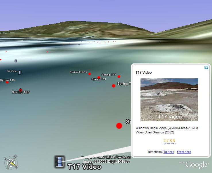
In the last paragraph of my previous post, I refer to having a strong cognitive connection to being able to "view a scene from the same position where I originally took a photograph". To clarify, here is a screenshot. Using the KML "LookAt" tag, an image can be referenced to both its geographic location and the camera vantage. Note that the horizon and ground coloration approximately match in the Google Earth representation and in the thumbnail image.

The photograph is of El Tatio Geyser Field, Chile. Though the imagery and elevation model is not high resolution, the connection between the photograph and the Google Earth scene allowed me to recall details of the location which I thought I had forgotten--there was actually something of a "eureka" moment.
Those fluent with Google Earth will find the tagging process easy; it can be done within the user interface without any manual KML coding. Another alternative is Surveylab's Ike unit--bundling a camera, GPS, laser distance finder, compass, and clinometer. With a little code, the whole "geovantaging" process could be automated.
If anyone knows of associated research literature dealing with such images, I would be very interested in hearing from you.
If you would like to view numerous interactive examples, visit the "Views" folder of my Chile Geysers KML database.
posted by Alan Glennon at
4:44 AM
![]()
